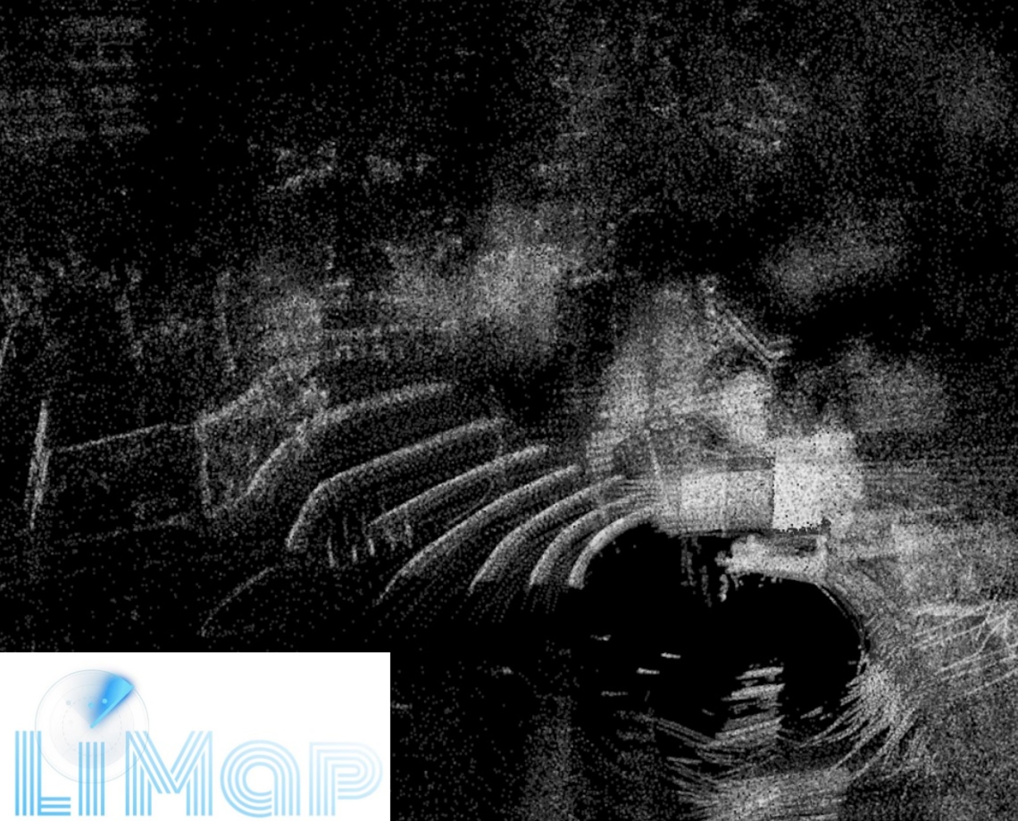
Visualization of pointcloud with Cartographer web viewer 2020
About our project
Lidar is a radar system which emits a laser beam to detect the target's position, speed and other characteristic quantities. Lidar working principle is to transmit laser beam to the target, and then compare the received signal reflected back from the target with the transmitted signal.
Our goal was to obtain the whole 3D map of Turku and make it accessible via browser. Unfortunately we did not have the needed recources to create a map of such scale, so we decided to simplify our work. We used 3D Lidar device to collect point cloud and imu data of Agora surroundings. Point cloud was processed with Google Cartographer and visualized with a point cloud web viewer. Cartographer is a system that provides real-time simultaneous localization and mapping (SLAM) in 2D and 3D across multiple platforms and sensor configurations.
Results
We used 3d lidar device to gather pointcloud data and Google cartographer was used to process the data. Cartographer is highly flexible and provides ways to configure the SLAM process. We made suitable configurations and produced a point cloud dataset in a form that can be visualized with web based solution. We implemented a point cloud web viewer that is hosted in Google Cloud. Solution is working rather well and it provides an easy way to visualize other point cloud datasets as well.
Improvements
-
Accuracy of the map should be improved in the next version & finding a way to reduce noise.
-
Instructions for users to help adjusting the render controls.
-
Using more comprehensive set of different sensors to improve the quality of the map.